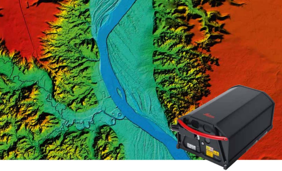
LIDAR & Photogrammetric Aerial Mapping
The Aerial Mapping Survey system consists of higher peformance of LIDAR & Photogrammetry imaging technology. The affordable Leica ALS80 LiDAR system features industry leading 1.0 MHz pulse rates and allows you to produce highdensity point clouds for general purpose mapping in a fraction of the time. Perform high-AGL mapping with nearly 8 km swath and with the fastest acquisition rates at all flying heights, even on low reflectivity targets. Imagine producing high density point clouds for corridor, urban, flood plain or general-purpose airborne mapping in a fraction of the time it took previously.
The Leica RCD30 is not only a true imaging innovation, it remains a masterpiece. This unique airborne camera offers performance that is otherwise only known from large format airborne sensors at a lower cost and thus makes digital multispectral photogrammetry available to everyone.
3D Modeling and Visualization
• Allows any physical object on earth to be recreated in a computer
• Using DEM (Digital Elevation Model) or DSM (Digital Surface Model) to represent bare earth
Vegetation Model
• Allows any physical object on earth to be recreated in a computer
• Using DEM (Digital Elevation Model) or DSM (Digital Surface Model) to represent bare earth model or surface model on it
Urban Planning
• Explore several aspects of the built and social environments
• Provides -3D city modeling
• LIDAR data can be incorporated into relief, rescue and flood simulation software to provide advanced